
Secret Lakes & Waterfalls
Hidden Gems
Water you have to ask a local about, or walk an hour to reach.
49 places
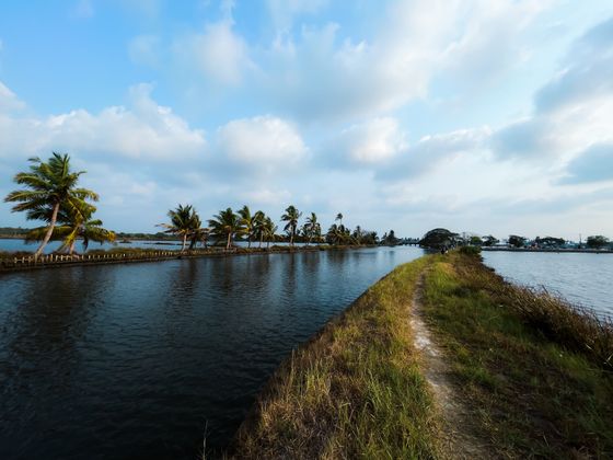
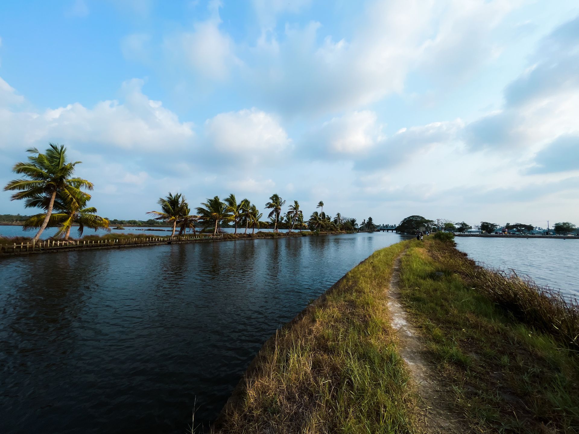
Alleppey (Backwaters)
Punnamada Lake Track
The historic backwater stretch that hosts the annual Nehru Trophy snake boat races, popular for evening walks.

Tirthan Valley
Jibhi Waterfall
A small fall a short walk through deodar from the village, on a path that gets slippery in the rain. Ten minutes each way, and busy through the afternoon.

Tsomgo Lake & Nathula Pass
Tsomgo (Changu) Lake
An oval lake at about 3,750 metres, held sacred locally and frozen over in winter. Yaks are brought down to the shore for photographs, at a price agreed before you sit on one. Permits are checked at the barrier below.

Saputara
Gira Waterfalls
About thirty metres, on the Ambika near Waghai, and worth the detour only during and just after the monsoon. By February it is a wet rock face.

Alleppey (Backwaters)
Vembanad Lake Basin
India's longest lake. The luxury houseboats run their circuits here, and the traditional resorts stand along its shores.
Khajjiar
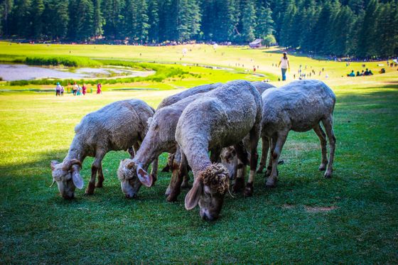
Khajjiar Lake
A small lake in the middle of the meadow with a floating mat of weed drifting across it. It is silting up and smaller than it was, so temper any expectation set by older photographs.

Arambol Beach
Sweet Water Lake
A freshwater lagoon just behind the beach, popular for a dip after the sea.

Meghalaya
Nohkalikai Falls
India's tallest plunge waterfall drops 340 metres in a single fall, into a pool of an odd green shade that most people notice before they take in the height. The catch is what feeds it: rainwater gathered on a comparatively small plateau above, so from December to February the flow thins and the picture you came for is largely bare cliff. Cherrapunji, now known as Sohra, is one of the wettest places on Earth, and this is the sight where that fact earns its keep. Come after rain, not in the dry months.

Kodachadri
Hidlumane Falls
A multi-tiered waterfall on the trekking route up to the peak.

Chopta (Tungnath)
Deoriatal Lake
A small lake that holds a reflection of Chaukhamba on a still morning, about two and a half kilometres up from Sari village. Camping on the far bank is permitted and is why most people come.

Chitrakote Falls (Bastar)
Chitrakote Falls Viewpoint
The horseshoe falls of the Indravati, widest in India.

Jibhi
Serolsar Lake
About five kilometres of level forest walking from Jalori Pass, through old oak. There is a small temple to Budhi Nagin at the water and a tea stall on the way. Snow shuts the pass in winter.
Great Himalayan National Park
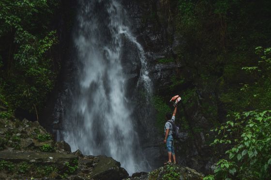
Chhoie Waterfall
About three kilometres up from the road head, short but steep, through forest. Best during and just after the monsoon; a trickle by late spring.

Pushkar
Pushkar Lake Ghats
Fifty-two ghats ring the water, each attached to a different community or ruler, and the lake is old enough to appear on coins from the fourth century BC. Hindu tradition calls it tirtha-guru, the teacher of pilgrimage places, and a bath here is held to wash away sin; more than five hundred temples stand around the shore. The crowds peak at Kartik Poornima in October or November, when the Pushkar fair runs. Shoes off on every ghat, and photographing people bathing is not welcome. A priest will press a puja on you the moment you sit down — fix the amount first or say no plainly.
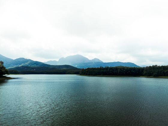
Matheran
Charlotte Lake
The primary natural water reservoir basin on the plateau, surrounded by dense evergreen forests and hosting an ancient temple shrine.

Pachmarhi
Bee Falls
A popular waterfall with a bathing pool amid the forest.

Saputara
Saputara Lake
The lake in the middle of town, with boats on it and a path around the edge. Half an hour, and it is what everyone does on arriving.

Chhattisgarh
Amritdhara Falls
The Hasdeo drops 27.4 metres here through a gap barely three to four and a half metres wide, so it reads as a column of water rather than a curtain. You reach it off the Manendragarh-Baikunthpur road, NH 43, in Manendragarh-Chirmiri-Bharatpur district: 30 km from Manendragarh, 50 km on from Chirmiri. That geography makes it a stop on a drive rather than a day out. Go in the weeks after the monsoon, while the river is still carrying water, and give it twenty minutes.

Haryana
Badkhal Lake
There is no lake. Mining in the hills around it drained the embankment two decades ago and it has stayed dry since, so anyone arriving expecting water gets a basin with the Aravallis behind it. The Haryana Tourism restaurants nearby still work, and a flower show comes every spring. What is left of the appeal is the setting — this is part of the leopard corridor running from Sariska up to the Delhi ridge — and the company it keeps: the 10th-century Surajkund reservoir is 15 km north, Anangpur Dam a kilometre further. Skip it unless you are already out this way.

Sikkim
Banjhakri Falls and Energy Park
A landscaped park built around a waterfall, seven kilometres out of Gangtok on the highway north, in thick forest at Swastik next to an army camp. The statuary and displays are about the Ban Jhakri, ban meaning forest and jhakri meaning healer, the shamanic healer who works with the spirits said to live in the caves around the falls. That story is genuinely local and you will not pick it up elsewhere. It is a made attraction rather than a wild one, so families do well here and anyone chasing solitude should keep driving.

Telangana
Bogatha Waterfall
The second largest waterfall in the Telangana region, on the Cheekupally stream in Wazeedu mandal, and until recently a long way from anywhere. The Eturnagaram bridge on National Highway 163 cut the drive from Hyderabad from 440 km to 329, which is the difference between an overnight trip and a very early start. Warangal is 140 km away and Bhadrachalam 120, so plan it from one of those if you can. Go after the monsoon has done its work; there is no point driving this far for a thin stream.
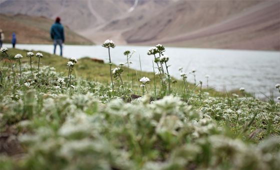
Himachal Pradesh
Chandratal Lake
Chandratal means Lake of the Moon, and the name comes from its crescent shape. It sits at roughly 4,250 metres in Lahaul and Spiti, on the Samudra Tapu plateau above the Chandra River valley, and measures about 2.5 kilometres around, ringed on every side by snow-covered ridges. The water is exceptionally clear and takes the peaks and the sky back like a mirror. The colour moves through the day from turquoise to aquamarine to deep emerald green. The area is a protected Ramsar wetland, and the alpine meadow around it is fragile.

Odisha
Chilika Lake
A brackish lagoon across three districts at the mouth of the Daya, second largest coastal lagoon in the world, and it changes size with the season, wide in the monsoon and well down by summer. The water runs fresh where rivers come in and as salty as the sea where the tide pushes back. Over 225 bird species use it, and it is a significant wintering ground for migratory waterbirds, so come in winter if birds are the point. Irrawaddy dolphins are here too, and 200,000 fisherfolk from more than 130 villages make their living on the water.
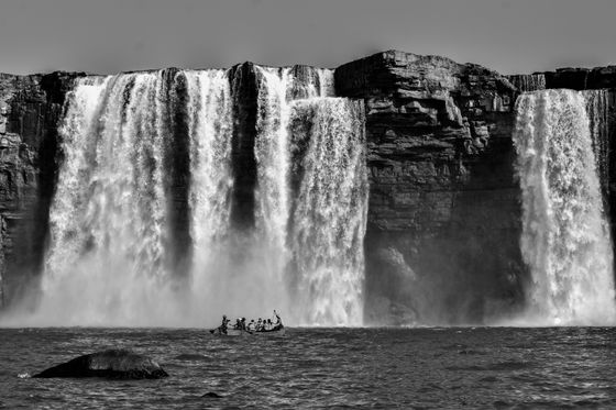
Chhattisgarh
Chitrakote Falls (Bastar)
Chitrakote, often called the 'Niagara of India', is the country's widest waterfall, where the Indravati River plunges in a dramatic horseshoe in the tribal heartland of Bastar, Chhattisgarh. A full horseshoe in the monsoon and a few channels by winter, it anchors a region rich in tribal culture and forests.

Arunachal Pradesh
Chumi Gyatse Falls
Local Buddhist tradition counts 108 falls here, spilling from between the mountains and read as the blessings of Guru Padmasambhava, who is said to have stayed five days in the Domtsang region. It was one of the three most sacred sites of eastern Tawang, but nothing built survives: no ancient township, no monastery still intact. What you get is water, rock and an unusual position, since by one account the falls stand about 250 metres from the Line of Actual Control. Come for the landscape and the border, not for a shrine to walk into.

Haryana
Damdama Lake
Timing decides whether this is worth the drive. The reservoir at Sohna, in the Aravalli hills near Gurugram, is monsoon-fed — a trough at the foot of the hills that fills to between 50 and 70 feet in the rains, sits at about 20 the rest of the year, and dries out altogether in summer. It is not a natural lake: the British dammed it with stone and earth in 1947 to harvest rainwater, and a government renewal scheme is still pending. The setting is the draw, an important biodiversity area on the Northern Aravalli leopard corridor between Sariska and Delhi, with Badkhal Lake and the 10th-century Surajkund reservoir nearby.

Jharkhand
Dimna Lake
Tata Steel put this reservoir in during 1944 because Jamshedpur was running short of water, and the city is still only 15 km away. It lies against the edge of the Dalma Wildlife Sanctuary, which is the better reason to make the trip: the lake and the forested hills come as one outing rather than two. Being this close to a working steel city, it is busiest on holidays. Go on a weekday morning if quiet water is what you are after.

Arunachal Pradesh
Ganga Lake (India)
Gyekir Sinyi is the local name, and the one worth using. It is a natural freshwater lake 6 km out of Itanagar, inside the Itanagar Wildlife Sanctuary, and the city treats it as its recreation ground, so a weekday morning is a very different place from a Sunday afternoon. The reason to linger is smaller than the water itself: 126 butterfly species have been identified around the lake. Stand still near the damp edges rather than walking straight round, and you will see more of them.

Bihar
Kanwar Lake Bird Sanctuary
A wandering river made this. The Burhi Gandak, a tributary of the Ganga, meandered across the plain in the geological past and left an oxbow lake behind — 2,620 hectares of it, the largest freshwater oxbow in Asia and around six times the size of the Bharatpur Sanctuary. It became Bihar's first Ramsar site in November 2020. Timing matters: the monsoon puts 1.5 metres of water across the site, and in the dry season the marshes dry out and get farmed. Counts stand at 221 bird species, with 58 migratory waterbirds using it as a stopover on the Central Asian Flyway. Manjhaul, 22 km north-west of Begusarai.

Sikkim
Khecheopalri Lake
The surface stays clear of leaves, and the local account is that birds lift each one off as it drops. Sit a while and see whether it holds. Buddhists and Hindus both treat the water as sacred and wish-fulfilling. Its older name, Kha-Chot-Palri, means the heaven of Padmasambhava; the local one, Sho Dzo Sho, means Oh Lady, Sit Here. The lake lies within the sacred Khechoedpaldri hill and belongs to the pilgrimage circuit running through Yuksom, Dubdi, Pemayangtse, the Rabdentse ruins, Sanga Choeling and Tashiding. Walk it as part of that rather than driving the 147 kilometres out from Gangtok for the lake alone.

Andhra Pradesh
Kolleru Lake
Winter is the whole point. Kolleru is the largest shallow freshwater lake in Asia, lying between the Krishna and Godavari deltas about 15 km from Eluru, and what brings people out are the birds that arrive in the cold months: painted storks, ibis, Siberian crane, and the grey or spot-billed pelican. It is shallow, and it is worked. Fishing communities continue their fish culture here under the Ramsar designation, so this is a living wetland rather than an empty one. It is fed by two seasonal rivulets and dozens of irrigation canals, which means how much water you find depends on when you come.

Meghalaya
Kynrem Falls
Three tiers, and the last one is where it gets interesting: the water splits into two rivulets that pick up speed and rejoin on the final leg. The drop totals 305 metres, seventh highest in India, and it sits inside Thangkharang Park, 12 kilometres out of Cherrapunji, so you see it from a laid-out park rather than at the end of a trek. That suits some visitors and disappoints others. Worth the stop while you are around Cherrapunji; not worth the drive on its own.
Lake Mansarovar
Lake Mansarovar, at 4,590 metres one of the highest freshwater lakes in the world, lies at the foot of Mount Kailash on the Tibetan plateau. Its turquoise water is deeply sacred to Hindus, Buddhists and Jains, and pilgrims bathe in and circumambulate the lake as part of the Kailash yatra.

Sikkim
Lake Menmecho
Start with the awkward part: the lake is closed to tourists, so treat anything calling it an attraction with suspicion. It lies at 3,830 metres on the road toward the Jelep Pass, twenty kilometres beyond Tsomgo, filled by snowmelt in summer and by the monsoon after that, and it is where the Rangpo chu rises before running down to the Teesta. The lake is known for its trout, and there is a large fish farm nearby with a guesthouse. Until that closure lifts, this is a name to know on the map rather than a stop to plan around.

Meghalaya
Langshiang Falls
Nobody has confirmed the height. The figure everyone quotes is around 337 metres, which would make it the 47th highest in India, and the fact that it has never been settled tells you how little attention this corner gets. It is a half-hour walk from Sangriang village, 24 kilometres out of Nongstoin in the West Khasi Hills. More than one fall runs here: the Kynshi pools in a cliff-ringed basin called Wei Spi before dropping into the gorge as kshaid Ur-Nar. You can also see it from Mawpon village if the walk does not appeal. A hydroelectric project on the Kynshi is coming.

Jharkhand
Lodh Falls
The Burha River falls through mid-forest inside Palamau Tiger Reserve, and what it makes is the highest waterfall in Jharkhand, and the 21st highest in India. Locally it is Budha Ghagh. It sits deep in Latehar district, so treat it as a half-day committed to one thing rather than a stop on the way to somewhere else. Waterfalls in this country run on the monsoon, so time the drive to the rain. And since the fall is inside a tiger reserve, check what access is being allowed before you set out.
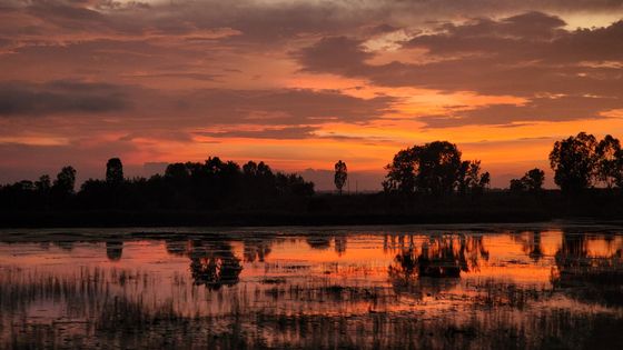
Manipur
Loktak Lake
Loktak Lake is the largest freshwater lake in Northeast India, famous for its phumdis — floating islands of vegetation that dot the water like a green patchwork. Near Moirang in Manipur, it has become an emerging offbeat destination for travellers seeking surreal landscapes far from the mainstream trail. The lake is home to the only floating national park in the world (Keibul Lamjao, refuge of the rare Sangai deer) and to fishing communities who live on the phumdis. Homestays on the lakeshore, sunrise boat rides and birdwatching make it a quiet, photogenic stop in India's far east.

Jharkhand
Lower Ghaghri Falls
Water drops 320 feet here into forest thick enough that the sun struggles to get through it, which matters if you are carrying a camera and is welcome if you are not. The Ghaghri, a tributary of the Auranga, makes the fall, and the sound of it carries through the trees. It ranks thirty-third among India's highest waterfalls, so come for the setting rather than the record. Netarhat is ten kilometres off, and the smaller Upper Ghaghri Falls sits four kilometres from Netarhat below the dam; take the two together or leave both.

Chhattisgarh
Mandwa Waterfalls
You will almost certainly arrive here on the way to something else, and that is the right way to treat it. Mandwa is a natural fall about 31 km from Jagdalpur, off NH 16 on the Jagdalpur-Geedam road, with Teerathgarh and Kanger Dhara close by. Sitting on a highway makes it easy to reach, and places that easy tend to collect people, so if you want it to yourself do not make it the last stop of an afternoon.

Meghalaya
Nohsngithiang Falls
Seven separate streams over the lip of a limestone cliff, 315 metres down and about 70 metres across on average, but only while it is raining. Outside the wet season there is nothing much to see, and that is the whole planning problem with this one. In full spate the segments stretch most of the way along the cliff face. Come late in the day, when the low sun lights the water and does most of the work for you. It is a kilometre south of Mawsmai village, and the Sohra area holds several more falls, Nohkalikai and Dain Thlen among them, fed by the same rain.

Arunachal Pradesh
Nuranang Falls
A hundred metres of falling water, two kilometres northeast of Jung on a road you can drive, which makes this the easiest big waterfall to reach in Tawang district. Jung sits 40 km southeast of Tawang on NH-13 between Tawang and Bomdila, just north of the Sela Tunnel, so it costs almost nothing to stop here if you are crossing anyway. A small hydel plant at the base supplies local electricity and is part of the view, take it or leave it. The river comes off the northern slopes of Sela Pass and joins the Tawang river shortly below the fall.
.jpg/960px-Usteri_Lake%2C_Pondicherry%2C_India_(21013490160).jpg)
Puducherry
Ousteri Lake
Puducherry's largest sheet of water, and only just Puducherry's: of roughly 800 hectares, 390 lie in the union territory and the rest across the line in Tamil Nadu, the border running near enough down the middle. Ossudu, its other name, comes from the village on its edge. This is a tank rather than a sight, one of the largest in the region, and what you get is open water and whatever happens to be on it. Drive out early if that appeals to you, and skip it without regret if it does not.

Himachal Pradesh
Rewalsar Lake
Three faiths hold the same small lake sacred — Hindu, Sikh and Buddhist — 22.5 km south-west of Mandi at about 1,360 metres. The shoreline runs only 735 metres, so walking the whole circuit takes no effort at all. Tibetan Buddhists call it Tso Pema and say Padmasambhava's spirit lives in the islands of floating reed on the surface; there is a colossus of him here, a shrine to Mandarava and three monasteries, plus Hindu temples to Krishna, Shiva and the sage Lomasha. If you have the legs, Kunt Bhyog sits higher up at around 1,750 metres.

Tripura
Rudrasagar Lake
Twijilikma is the local name, and the lake sits at Melaghar carrying two designations most Indian water bodies do not: the environment ministry lists it as a wetland of National Importance for its biodiversity and its socio-economic role, and the secretary general of the Ramsar Convention declared it a wetland of international importance, communicated to India in February 2007. What that amounts to on the ground is open water and wetland rather than built attractions, so come for the quiet rather than for something to look at.

Chandigarh
Sukhna Lake
The water here is engineered. Sukhna was made in 1958 by damming the Sukhna Choe, a seasonal stream coming down from the Shivalik hills, and its three square kilometres are fed by rain rather than by a river. Silt nearly finished it: twenty-five square kilometres of catchment were acquired and put under vegetation, and in 1974 the choe was diverted to bypass the lake completely, which is now fed through three siltation pots instead. Worth knowing before you look at it. This reads as a Himalayan foothill lake, but every part of it was put there.

Meghalaya
Thadlaskein Lake
Someone dug this. The folktale gives the credit to Sajar Nangli, a young man who set his followers to the work in the middle ages, and the lake still carries his name as Pung Sajar Nangli. It lies right on National Highway 6 beside the small village of Mukhla, which makes it a five-minute stop rather than an outing. Pull over, walk a stretch of the bank, carry on. Do not plan a day around it.
Sikkim
Tsomgo Lake & Nathula Pass
Tsomgo Lake, also written Changu Lake, is a high-altitude glacial lake at 3,753 metres in the rugged East Sikkim district, held in a steep oval valley just kilometres from the international border. The water changes colour through the year: deep blue in summer, turquoise later, then solid white once winter locks the surface into thick ice. Carry on up the same high-security mountain road and it climbs to the Nathula Pass checkpoint, at 4,310 metres on the ancient Silk Road route, where heavy military wire marks the line between India and China.

Mizoram
Tuirihiau falls
You can stand behind this waterfall. Caves run in behind the falling water at Tuirihiau, and that is the reason to come, because plenty of falls look good from the front and this is one you get to see from the other side. It drops on the Vanva river near Buangpui, five kilometres south of Thenzawl in Serchhip district, and gets mentioned in the same breath as Vantawng, which is close by. Do the two of them from Thenzawl in a single outing.

Meghalaya
Wah Kaba Falls
You get this one from the car, in the good sense: it comes into view on the drive from Shillong to Cherrapunji, drops somewhere between 170 and 190 metres off a steep rockface into a gorge, and asks nothing of you but a stop. Local legend puts two fairies at the falls. It is not a destination in its own right and does not need to be. Pull over, give it ten minutes, and carry on to Cherrapunji.

